Boreas Ponds Interim Access Plan Criticized
Adirondack Almanack
September 15, 2016
Some Forest Preserve advocates are concerned that the state’s decision to allow people to ride mountain bikes to Boreas Ponds under an interim-access plan could become the permanent policy for the newly acquired Boreas Ponds Tract.
Willie Janeway, executive director of the Adirondack Council, and David Gibson, a partner in Adirondack Wild: Friends of the Forest Preserve, criticized this and other aspects of the interim plan released by the state Department of Environmental Conservation in late August.
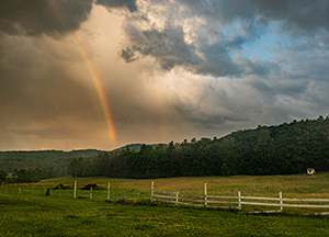
The interim plan allows the public to drive 3.2 miles up the dirt Gulf Brook Road. From there, people can hike or bicycle the remaining 3.6 miles to the ponds.
Forest Preserve advocacy groups support a Wilderness classification for Boreas Ponds and the lands around it. Bicycles are not allowed in Wilderness Areas.
The fear is that if bicycling becomes an established use, state officials will be reluctant to adopt a classification that prohibits it.
“The rules say they shouldn’t be doing anything that biases or predetermines future decisions,” Janeway told Adirondack Almanack last week.
Adirondack Wild raised the same objection in a letter this week to DEC Commissioner Basil Seggos. “Authorizing public bicycling on the entire Gulf Brook Road and all the way to Boreas Dam establishes patterns of mechanized use that, contrary to your intent, will foreclose options for or at a minimum build in bias against eventual Wilderness classification.”
When DEC released the interim plan on August 31, it declared that it “does not have any bearing on the future land classification of the tract currently in development and does not prejudge what access and uses will be allowed in the future.”
North Hudson, where Boreas Ponds is located, and other local towns are urging the state to open all of Gulf Brook Road as well as some other old logging roads to bicycles.
Built for logging trucks, Gulf Brook Road seems capable of withstanding bicycle traffic, but Janeway said allowing people to bicycle to the ponds would diminish the wilderness experience.
“Part of wilderness is the solitude and the amount of effort to get there,” Janeway remarked.
Nevertheless, the council backs a proposal that would allow the public to drive 5.7 miles up Gulf Brook Road to LaBier Flow, an impoundment of the Boreas River. No cars or bikes would be allowed beyond the flow, but from there the ponds can be reached by an easy mile hike.
Why not close the entire road? A new group, Adirondack Wilderness Advocates, has proposed just that. Under this plan, people would have to hike 6.8 miles to get to the ponds.
Janeway conceded that “the wilderness purist in all of us can be attracted to that,” but he said the proposal backed by the council and a number of other groups seeks to strike a balance between wilderness protection and recreational access. For example, closing the entire road would make the ponds inaccessible to all but the most determined paddlers.
Bill Ingersoll, one of the founders of Adirondack Wilderness Advocates, contends that the interim plan is unlikely to satisfy bicyclists or paddlers.
“The older paddlers, who seem to be most in favor of road access, will find that the length of the carry [3.6 miles] is too long. Bikers will find the requirement to stick to the one approved route to be a baffling restriction,” he said.
Neil Woodworth, executive director of the Adirondack Mountain Club, agreed that 3.6 miles is too long a carry for most people (though it can be shortened a half-mile by paddling across LaBier Flow). “If you’re going to allow reasonable recreational access, you wouldn’t leave the parking that far from the ponds. That’s still too much of a distance for most users of canoes and kayaks,” he said.
Woodworth also called “perplexing” the decision to allow bicyclists to ride to the dam at Boreas Ponds. “If the goal is to preserve a wilderness setting, you wouldn’t allow mountain biking all the way to the dam,” he said.
Unlike Janeway and Gibson, though, Woodworth does not believe the interim plan will influence future decisions about the long-term management of the tract. “I’m not sure it means a heck of a lot for the eventual classification,” he said.
Adirondack Wild also criticized the interim plan for opening the first 3.2 miles of Gulf Brook Road to motor vehicles. Since motor vehicles are prohibited in Wilderness Areas, Adirondack Wild argues that the road should have remained closed to vehicles until the state decided where to draw the Wilderness boundary.
Peter Bauer, executive director of Protect the Adirondacks, believes the interim plan is a preview of DEC’s plans for the Boreas Ponds Tract. “By allowing motor vehicles to use the first 3.2 miles of the Gulf Brook Road and mountain bikes to ride to the Boreas Ponds dam, the state is clearly fleshing out its eventual designs,” he said. “Mountain biking and motor vehicles are uses confined to Wild Forest Areas. It appears we may be seeing a Wilderness-Wild Forest boundary emerging.”
North Hudson Supervisor Ron Moore said he is generally pleased with the interim-access plan. “Obviously, I would have liked to see [vehicle] access to LaBier Flow. That being said, we are 3.2 miles in. We’re hoping for closer access in the future,” he said.
Moore supports allowing bicycles to ride to Boreas Ponds and on old logging roads that loop around the ponds. “I’m happy that as a start we have bicycling to the ponds,” he remarked.
He also wants the state to allow horse and wagons to use other logging roads that circle the ponds in a larger loop.
Another criticism of the interim plan is that many of “53 miles of roads” it refers to have not been maintained in years and have been reclaimed by nature. “Thus, the characterization of the Boreas tract as having ‘supported a significant amount of mechanized and motor vehicle use prior to acquisition’ is inaccurate and unsupported,” Adirondack Wild said in its letter to Seggos.
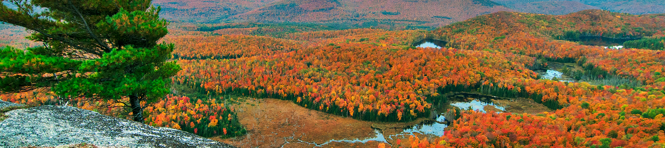
The state bought the 20,758-acre Boreas Ponds Tract from the Nature Conservancy in April. It was the last piece in a deal to acquire 65,000 acres of former Finch, Pruyn lands from the conservancy.
Environmental groups want the ponds and most of the tract added to the High Peaks Wilderness. The Adirondack Park Agency will soon begin deliberating on the classification of the tract. After that, DEC will write a management plan, which the APA must approve.