A bigger wilderness
Adirondack Explorer
January 18, 2016
By Phil Brown
In 1936, the conservationist Bob Marshall made a list of forty-eight forested areas in the United States that exceeded three hundred thousand acres and that remained roadless—that is, relatively pristine. Evidently, he considered three hundred thousand acres to be the minimal size of a true wilderness.
“We would like to point out that the 300,000 acres is not a roadless area in any pioneering sense,” Marshall wrote in the magazine Living Wilderness (with co-author Althea Dobbins). “Actually, a 300,000-acre tract is only about 21½ by 21½ miles, something which a reasonably good walker could traverse readily in a day if there were a trail.”
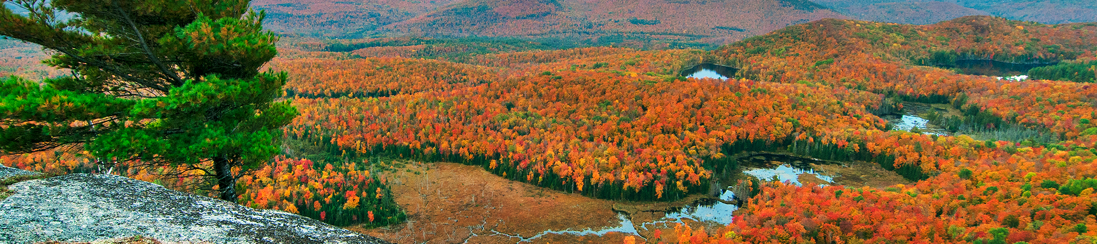
Although the Adirondack Park boasts more than a million acres of officially designated Wilderness, where motorized use is forbidden, no single Wilderness Area comes close to Marshall’s criterion. The High Peaks Wilderness—the largest in the Park—covers only 204,000 acres.
If the Adirondack Council and several other environmental groups get their way, the High Peaks Wilderness will grow dramatically in the near future. In November, the council and seven other groups sent a letter to Governor Andrew Cuomo setting forth a proposal to expand the Wilderness Area to more than 280,000 acres—a 39 percent increase in size, leaving it less than twenty thousand acres short of Marshall’s threshold.
“You have an extraordinary opportunity to create a true national legacy, an Adirondack wilderness area here in New York whose scale and positive impacts will rival some of the most famous conservation landmarks in the world,” the groups wrote the governor.
Besides the council, the organizations endorsing the letter were the Adirondack Mountain Club, Adirondack Wild: Friends of the Forest Preserve, Audubon New York, Citizens Campaign for the Environment, Natural Resources Defense Council, and New York League of Conservation Voters.
Protect the Adirondacks, one of the Adirondack Park’s major green groups, declined to sign the letter, citing objections to parts of the proposal.
The Adirondack Council and its allies are urging the governor to expand the Wilderness Area after the state purchases the 20,500-acre Boreas Ponds Tract from the Nature Conservancy. This will be the last acquisition in a multi-year deal with the conservancy to add sixty-five thousand acres of former Finch, Pruyn timberlands to the Forest Preserve. The state plans to buy Boreas Ponds by March 31, the end of the fiscal year, if not sooner.
The Boreas Ponds lie just south of the High Peaks Wilderness, and the groups say most of the tract should be added to the Wilderness Area, along with other state-owned lands.
As part of the Finch deal, the state bought two large tracts near Tahawus, known as MacIntyre East and MacIntyre West, and a smaller parcel, the Casey Brook Tract, near Elk Lake. The groups maintain that all of Casey Brook and MacIntyre West and most of MacIntyre East should be added to the High Peaks Wilderness. Furthermore, they say a parcel bordering MacIntyre West, acquired from the Open Space Institute, also belongs in the Wilderness Area. Finally, the groups say part of the Vanderwhacker Wild Forest adjacent to the Boreas Ponds Tract should be reclassified as Wilderness.
All told, the classification of new state lands and reclassification of old state lands would add about thirty-five thousand acres to the High Peaks Wilderness.
The Boreas Ponds Tract and Casey Brook form a link between the High Peaks Wilderness and the Dix Mountain Wilderness. Therefore, the groups recommend combining the two, in part to streamline management of the lands. This would add another forty-five thousand acres to the High Peaks Wilderness.
Under the proposal, the High Peaks Wilderness Area would grow to a grand total of 284,000 acres. In the Adirondacks, this is big.
The West Canada Lake Wilderness, the second-largest in the Park, encompasses 171,000 acres. Compared with Wilderness Areas in Alaska and in the far west, however, it’s still puny. The Frank Church – River of No Return Wilderness in Idaho, for example, is 2.4 million acres and several Wilderness Areas in Alaska are substantially larger. Nevertheless, the environmental groups point out that the expanded High Peaks Wilderness would be larger than Rocky Mountain National Park in Colorado or Mount Rainer National Park in Washington.
“It would give the highest level of environmental protection to the most sensitive lands the state possesses,” said John Sheehan, a spokesman for the Adirondack Council. “The state’s tallest mountains, wildest rivers, and most sensitive wildlife habitat are located in this relatively compact area.”
The most controversial piece of the proposal is the call to designate most of the Boreas Ponds Tract as Wilderness, the most restrictive of the land-use classifications for the Forest Preserve. Most of the Forest Preserve in the Adirondacks is classified either Wilderness or Wild Forest. The most significant difference is that motorized use is prohibited in Wilderness Areas, whereas some motorized use is allowed in Wild Forest Areas. Bicycling also is banned in Wilderness Areas.
Boreas Ponds is in North Hudson, and the town supervisor, Ron Moore, wants to see the tract classified as Wild Forest to facilitate public access and maximize recreational opportunities. For example, he said old logging roads in the area would be ideal for bicycling.
“We’re not looking to destroy the environment,” he said. “We’re looking to use an existing infrastructure of roads. We want as many people to enjoy the area as possible.”
Moore argues that the general public should be able to drive on one of those dirt roads—Gulf Brook Road—to within three quarters of a mile of the ponds. The disabled and those with special permits should be able to drive to within a quarter-mile, he said.
Under the environmentalists’ plan, people would be able to drive only as far as LaBiere Flow, a little over a mile from the ponds. From there they’d have to hike the rest of the way or paddle and carry their canoe up the flow and the ponds’ outlet.
Moore says the same road should serve as part of a snowmobile trail connecting North Hudson and Newcomb to the west. The council and its allies are calling for the snowmobile trail to be located a few miles farther south, paralleling Blue Ridge Road, a county highway.
“I can drive a car on the highway,” Moore said. “I think I would rather [snowmobile] in the woods and enjoy the scenery.”
The environmentalists want to extend the Wilderness Area all the way to the proposed snowmobile route—that is, nearly to Blue Ridge Road. The rub is that Gulf Brook Road then would fall within the Wilderness boundaries. To allow people to drive to LaBiere Flow, the plan calls for designating Gulf Brook Road a Primitive Corridor.
This use of the Primitive classification is the foremost objection of Protect’s Bauer. He contends that Gulf Brook Road should serve as the Wilderness boundary, leaving the road itself in Wild Forest. Thus, people would still be allowed to drive to LaBiere Flow. Bauer agrees with Moore that the road also should be used as a snowmobile trail. Cutting a new trail farther south, he said, would kill thousands of trees.
“If we’re going to have a motorized road, it should be in a Wild Forest Area,” Bauer said. He argues that creating a motorized Primitive Corridor—when there are no private in-holdings and no history of public use—would be a misuse of the Primitive classification and weaken the Adirondack Park State Land Master Plan. The same rationale, he warned, could be used in the future to allow motorized incursions into other Wilderness Areas.
“It’s vitally important for the future of the Forest Preserve and public recreational management that we keep public motor-vehicle use in Wild Forest Areas,” he said. “It would be a grave mistake and create many serious long-term problems if we allow motorized recreation beyond Wild Forest Areas and into Primitive and Wilderness Areas.”
Primitive Areas are managed as Wilderness, but for one reason or another, they cannot be classified as such. Usually, they are too small or there is some use or structure that is inconsistent with Wilderness. Generally, the inconsistent use precedes the classification.
Yet, two founding figures of the Adirondack Park Agency, Peter Paine and William Kissel, have written a letter in support of the proposal of the eight environmental groups (see page 35), saying it conforms to the State Land Master Plan. Paine was the principal author of the master plan, and Kissel was the APA’s first counsel. Both also served on the APA board.
“A Primitive Area giving road access along the Gulf Brook Road to LaBiere Flow south of the Boreas Ponds themselves would permit road access to the Boreas Ponds area but preserve the integrity of the larger Wilderness,” they wrote.
In response to Bauer’s objections, Willie Janeway, the council’s executive director, said the groups want to maximize the amount of land added to the High Peaks Wilderness and keep snowmobiles out of the interior of the Forest Preserve. “There are some very wild lands south and west of the Gulf Brook Road that deserve Wilderness protection,” he said. “We don’t agree with those who want a smaller Wilderness.”
But Bill Ingersoll, publisher of the Discover the Adirondacks guidebooks, criticizes the plan for compromising on Wilderness. He argues that all of Gulf Brook Road should be closed, even though this would require people to hike eight miles or so to reach the ponds.
“The appeal of Wilderness is directly related to the absence of motor-vehicle access,” Ingersoll said in an email to the Explorer. “The ponds should be the destination, not the scenery behind a trailhead parking lot. The presence of an active motor-vehicle road would negate the benefit of the Wilderness designation.”
Bauer’s other objection is that the groups favor keeping and maintaining a concrete dam at the foot of Boreas Ponds. To maintain the dam, state officials would be allowed to drive on Gulf Brook Road all the way to the ponds. In their letter to Cuomo, the groups said the dam is needed to preserve “a special brook trout fishery, and a remarkable paddling destination.”
Bauer questioned the appropriateness of maintaining this dam as well as a smaller one on LaBiere Flow. Wilderness Areas are supposed to be largely free of manmade structures, and Bauer noted that most dams in the High Peaks Wilderness have been removed or allowed to deteriorate. “We think there should be a real conversation about whether there should be dams in a Wilderness Area,” he said.
Bauer contends that the Boreas Ponds dam is not needed to protect the fishery, saying brook trout live throughout the ponds and their channels as well as in the ponds’ outlet and LaBiere Flow. “Whether the dam stays or goes, it’s going to stay brook-trout habitat,” he said.
Bauer also said people would still be able to paddle on the ponds if the dam is removed.
In response, Janeway asserted that the brook trout will be better protected if the dam is maintained. “With climate change warming Adirondack lakes and streams, we know deeper waters are more likely to provide refuge for brook trout,” he said. “The information we have seen to date has led us to believe that it is ecologically important to preserve the Boreas Ponds. We will continue to evaluate the science.”
Protect does agree with the other groups that most of the Boreas Ponds Tract and other former Finch lands in the vicinity should be added to the High Peaks Wilderness. Bauer also said “it’s worth taking a look” at combining the Dix Mountain and the High Peaks
Wilderness Areas.
Three years ago, the state Department of Environmental Conservation set forth in a memorandum its own preliminary ideas for classifying the Boreas Ponds Tract. Like Protect, DEC suggested that Gulf Brook Road could serve as the Wilderness boundary and as a snowmobile route. Unlike Protect, the department also favored maintaining the dam for the sake of fishing and paddling.
DEC spokeswoman Lori Severino said the department will address the issues surrounding the dam and the road after the state buys the property. She added that “historic fisheries information gathered over the winter months will be important in making future decisions.”
The eight environmental groups also are calling for the removal of a lodge at Boreas Ponds. Finch, Pruyn used it as a corporate retreat. Moore, the town supervisor, argues that the lodge should be retained for possible use as a ranger station or as overnight accommodations in a hut-to-hut trail system.
“You’ve got a beautiful lodge looking at the High Peaks,” he said. “It just doesn’t make sense to me to tear it down.”