Beyond Boreas | Other Adirondack Park Agency Classification Decisions to Watch
Thursday, January 25, 2018
By Rocci Aguirre - Adirondack Council Director of Conservation
This article originally appeared in the Adirondack Almanack on Wednesday, January 24, 2018.
The Boreas Tract is just one part of the proposed classification or reclassification of 54,418 acres of state lands in the Adirondack Park. The Governor’s Adirondack Park Agency drafted a set of amendments to the Adirondack Park State Land Master Plan (SLMP) that included some 100 other proposed classifications, reclassifications, and/or map corrections as part of a large Appendix A of the draft Supplemental Environmental Impact Statement (SEIS).
 Boreas Ponds
Photo by Carl Heilman
While most of the attention to date has been focused on the high profile 20,543 acre Boreas Ponds Tract, APA watchers expect the Agency to soon release the proposed final set of amendments to the Master Plan for all 100 plus proposed actions.
Below is a list of some of the other state land classification protection decisions that will signal to stakeholders if the state’s direction is good or bad for the legacy of Adirondack Wilderness protection. Decisions on these lands will tell if the state is honoring and maintaining it’s commitment to prioritizing protection of natural resources and Wilderness.
The proposed actions encompassed within Appendix A affect over 30,000 acres of new Forest Preserve lands, excluding the Boreas Ponds Tract, plus an estimated 3,591 acres in reclassifications and map corrections. Together, these represent an unprecedented modification of the State Land Master Plan for the Adirondacks at a Park-wide scale. Overall, the vast majority of the generic map corrections and classification of some of the smaller new Forest Preserve parcels are routine and make sense.
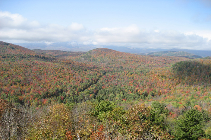 Belfry Mountain
However, there was and remains concern that the DSEIS suffered from an overall lack of analysis, particularly of the larger, more complex tracts, and did not meet the criteria, prerequisites, and legal requirements demanded by SEQRA and the Master Plan. A revised plan could correct that. As was stated by the Adirondack Park Agency at all eight public hearings, the classification process should essentially follow the same format and criteria for all new lands, regardless of size and current condition. The method for classifying the remaining 32 new parcels should remain consistent with SLMP guidance.
At hearings, the call to modify the proposed actions to include more Wild Forest was always tempered by those calling to see more Wilderness. At an almost 2:1 ratio across New York State, wilderness advocates have made their voices heard and have shown just how valued Adirondack Wilderness is. As with the Boreas Ponds Tract, the State should have provided classification options that prioritize the protection of the natural resources in and around these parcels and fulfill the primary directive of the SLMP as presented at the start of each public hearing. The people of New York, the Adirondack Park State Land Master Plan, the science, the law, history and the future legacy of the Adirondacks demands that rigorous attention to detail and a full accounting of the process occurs.
Here are 15 classifications to watch carefully. Individually and collectively they will signal the direction of the Governor’s Park Agency with regard to process and priorities.
1. ES-09: East Branch Ausable: This should remain an addition of lands to the Hurricane Mountain Wilderness in the Town of Keene. The similarities between this and HM-06 and HM-07 are remarkable, including the possibility of Wilderness lands extending down to a public road corridor. Refer back to this when looking at HM-06 & 07.
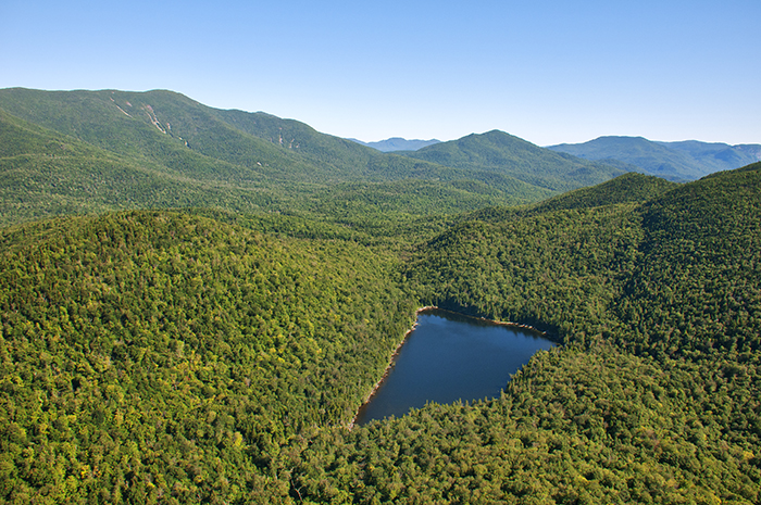
2. ES-16: MacIntyre West: The 7,365-acre MacIntyre West tract (with a small exception) should be added to the High Peaks Wilderness. It meets all appropriate criteria for Wilderness classification. A small primitive area proposed by the APA appears appropriate.
3. ES-17: MacIntyre East: A Wilderness classification should be applied to approximately 4,445 acres on the northern section of the MacIntyre East Tract and this acreage should be included into an expanded High Peaks Wilderness Area. The 1,600 acres making up the southern portion of this tract warrant a Wild Forest classification action.
4. ES-18: Hudson River Hyslop: A Wild Forest classification is appropriate here.
5. ES-19: Casey Brook: A Wilderness classification is necessary for this critical component for a Wilderness link between the Dix and High Peaks Wilderness Areas.
6. ES-26: Palmer Pond: This proposal should change from Wild Forest to majority Wilderness, including the small ridge and the land north and east of the ridge connecting to the Dix Wilderness. While this small parcel is oddly configured on the west and has noted constraints including its proximity to the Northway and a segment of the North Hudson-to-Newcomb Snowmobile Connector trail, the proposed action to classify the entire parcel as Wild Forest when it fully adjoins the Dix Mountain Wilderness is wrong.
7. ES-27: Niagara Brook: This proposal for Wild Forest should change to include a Wilderness Buffer for Niagara Brook. In the draft there was no analysis of why a wilderness corridor exists for both sides of Niagara Brook upstream of this parcel, but not through this parcel. The approximately 1,000’ wilderness buffer on the west side of Niagara Brook should be extended down through this parcel.
8. ES-29: Belfry Mountain: Will this tract be deemed “Historic” like other envelopes for other historic fire towers within the Park?
9. FL-01/HM- 10: Benson Road Tract: Portions of this parcel have long been identified as being compatible with a Wild Forest classification. However, as was noted at length throughout the public hearings, the state needs to conduct a full, fair, and rational evaluation of the viability of having a major portion of the Benson Road Tract north of the existing snowmobile trail serve as a component of a new 12,000-acre West Stony Creek Wilderness Area. Look to see if there is the required “hard look” analysis of the feasibility of Wilderness here.
10. Fr-02: Long Pond Mountain: This proposal should change to Primitive. The Long Pond Mountain tract consists of 2,141 acres of lands donated by the Heartland Forest Fund in 2012 as a component of the deal that allowed for retained hunting camps/leases to remain on conservation easement lands. The long-anticipated expectation was that these lands would be added to the adjoining Deer River Primitive Area, which these new lands adjoin for approx. 4.75 miles along the entire length of the western property boundary. In comparison, the new lands share a common boundary with the Debar Mountain Wild Forest for only approx. 0.3 miles.
11. HM-02/03: Cedar Ridge/Township 33: The addition of these parcels to the Blue Ridge Wilderness Area is appropriate given that they fully adjoin current Wilderness and would otherwise meet all criteria set forth by the SLMP.
12. Hm-05: Good Luck Tract: This should be changed to a proposal for Wilderness and/or Primitive given the proximity of this parcel to both the Hudson Gorge Wilderness and Siamese Ponds Wilderness.
13. HM-06: Hudson Gorge: This should be changed to a Wilderness Primitive combination. Wilderness classification should be made north of the utility line and Primitive between the road and the utility. See ES-09 in Keene and HM-07 in Indian Lake, since these parcels are remarkably analogous and all are bisected by a utility line.
14. HM-07: Raquette Brook: This should be changed to a Wilderness Primitive combination (see HM-06 and ES-09). The DSEIS proposed that the classification for this parcel should be Primitive but then identifies within the description lands proposed for addition to the Vanderwhacker Mountain Wild Forest. There were errors and significant confusion with either how this tract is mapped or described or both. There appears to be no unit of Wild Forest adjoining either this or the HM-06 Tract. There would appear to be no deed restrictions, non-conforming uses, or leases that would impede this tract being classified Wilderness north of the utility line and Primitive south of the utility line, depending on the nature of the private landownership. The proposal fails to justify why the lands south of the power line would be proposed for classification as Wild Forest and not Primitive.
15. RC-06: Cathead Mountain: The Adirondack Council has long supported the addition of Cathead Mountain into the Silver Lake Wilderness Area if and when the large inholding of private land is acquired. Watch to see if this is this reclassification is changed or delayed as some requested, and if so, if the stated reasons comply with the law.
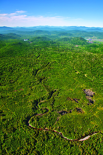
 Lake Andrew - MacIntyre West TractPhoto by Carl Heilman
Both the DSEIS and the presentations used to start each of the eight public hearings in November and December of 2016 started with the firm exclamation that the unifying theme of the SLMP is that the protection of natural resources is paramount and that recreation is secondary. While future uses are an intrinsic part of the discussion, the APA is mandated through the State Lands Master Plan to classify State lands in accordance with their characteristics and capacity to withstand use. As was noted in the DSEIS and presented by APA staff at the start of each public hearing was a lead slide underscoring, “the protection and preservation of the natural resources of the state lands within the Park must be paramount. “Human use and enjoyment of those lands should be permitted and encouraged, so long as the resources in their physical and biological context, as well as their social or psychological aspects are not degraded.” (SLMP, page 1.)
The underlying natural resources and the potential for restoration to Wilderness is very relevant to the classification of areas with old infrastructure including roads, culverts, camps and bridges. The SLMP lists many non-confirming uses that have been or are supposed to be removed to bring wilderness areas into conformity with this definition. They include old state truck roads, ranger cabins, and more. Since the creation of the Forest Preserve in 1886 and the adoption of the Forever Wild clause of the New York State Constitution in 1894, it has been the policy and obligation of state government to restore the wild character and ecological health of the Adirondacks following decades of extensive clearcutting and forest fires that had severely impacted more than 90 percent of the ancient forest that once covered this landscape. Only about 300,000 acres of true, old-growth forest still exist here. All of the rest of our Wilderness system is wilderness-in-recovery. 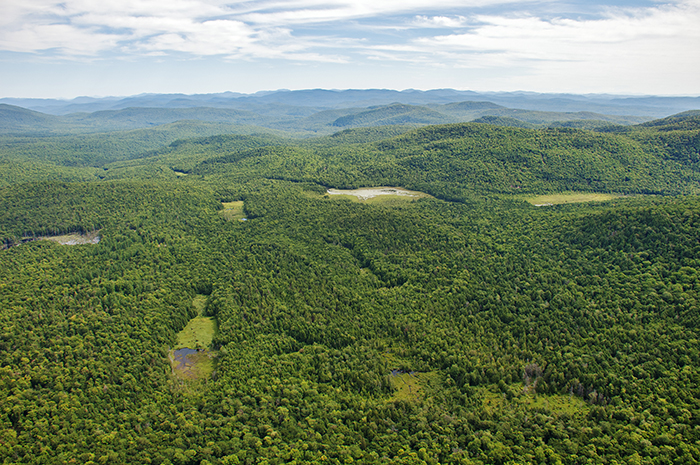 Benson Road Tract
Photo by Carl Heilman
That previous logging operations and a network of “roads,” “winter roads” and “skidder trails” were built on various tracts as a component of former logging operations and hunting camp leasing does not preclude a parcel from meeting the high standards of a Wilderness classification. Many Wilderness Areas of the Park, including the Blue Ridge, McKenzie Mountain, Siamese Ponds, and Whitney Wilderness Areas all saw significant timber harvesting before coming into the Forest Preserve. Nothing relating to past forest management activities on any of the parcels contained in Appendix A prevents them from being classified as Wilderness under the SLMP. In fact, the SLMP requires consideration and prioritization of opportunities to “enhance and restore, where necessary” wilderness.
While most of the proposed classification actions associated with Appendix A appear to be administrative and not controversial, we and others wait to see if the Agency provides a higher level of detail and information in any new proposal.
The Adirondack Park is a national treasure. The largest park in the contiguous United States, it is globally unique because of its ecology, scale, landscape scale protections, and unique legal safeguards. Many of our country’s environmental protections on park and wilderness areas are threatened by proposals and actions coming out of Washington. In New York, the state has an opportunity to lead in a better direction.
 Tahawas East - Opalescent River
 Rocci joined the Adirondack Council staff in 2013 as Director of Conservation. He is responsible for the design and implementation of the Council's conservation strategy. Rocci holds a MS in Resource Management and Conservation from Antioch University New England. Rocci’s previous work experience includes eight years spent as a ranger with the National Park Service, as field staff for Trout Unlimited and in the Catskills. overseeing land protection efforts for the Finger Lakes Land Trust in Ithaca, NY and the Monadnock Conservancy in Keene, NH. When not fly fishing or hunting, Rocci can usually be found hiking in the woods looking for chanterelles or other delicious ingredients to add to the supper pot.
![]()